Much of the world depends upon satellite systems for precise navigation and timing services. The global positioning system (GPS) is a ubiquitous and problematic technology. Global navigation satellite system (GNSS) is the umbrella term for satellite navigation systems that provide autonomous geo-spatial positioning with global coverage. GNSS includes GPS, GLONASS, Galileo, Beidou, and other regional systems. A closely-related concept is a position, navigation, and timing (PNT) systems.
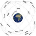
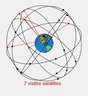
There are 31 satellites in the GPS constellation, 27 of which are in use at a given time, with the rest allocated as stand-bys. The additional satellites over 24 improve the precision of GPS receiver calculations by providing redundant measurements. With the increased number of satellites, the constellation was changed to a nonuniform arrangement. Such an arrangement was shown to improve accuracy and also improves reliability and availability of the system, relative to a uniform system when multiple satellites fail. With the expanded constellation, nine satellites are usually visible from any point on the ground at any one time, ensuring considerable redundancy over the minimum four satellites needed for a position.
GPS/GNSS/PNT jamming, spoofing, and other forms of interference are growing in frequency and severity. And space-based systems are not immune to severe space weather or cyber-attack. According to a London School of Economics report, loss of satellite navigation for five days would cost the U.K. more than £5.1 billion. And according to the U.S. National Institute of Standards and Technology, failure of the GPS would cost the US economy $1 billion a day and up to $1.5 billion a day if it occurred during planting season for farmers. But GPS outages are surprisingly common.
As a result, there are numerous efforts underway to develop alternatives to today’s space-based technologies. This three-part FAQ series will first look at various failure modes for space-based GPS/GNSS/PNT systems and the U.S. and European programs to identify alternative technologies. Part two will look at existing terrestrial-based alternatives to GPS/GNSS/PNT satellites. Part three will look into the future at possible quantum-based and optical-based PNT technologies that could eliminate GPS devices’ needs.
Jamming, spoofing, meaconing, and other GPS failure modes
GPS vulnerabilities include unintentional interference such as radio frequency interference, ionospheric interference caused by solar activity, and intentional interference such as jamming, spoofing the system with counterfeit signals, and electromagnetic pulse (EMP) attacks on the satellites. There is currently only minimal protection against ionospheric interference caused by solar activity or EMP attacks by an enemy. A massive solar storm, similar to the Carrington Event of 1859, could knock out the entire GPS satellite network.
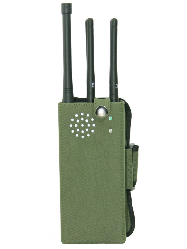
The signals sent out by the satellites are more vulnerable than the satellites themselves. Jamming is simple and inexpensive, with jamming devices costing under $200. While the jamming devices are illegal in many countries, including the U.S., they are made in large quantities in China and are readily available. The military regularly jams GPS in certain areas while testing equipment or during military exercises. The US Government also regularly performs tests and exercises that lead to disruption of the satellite signal.
Meaconing is the interception and rebroadcast of navigation signals. Meaconing avoids the burden of implementing the generation of the complex GNSS signal structures and C/A codes and also causes the GNSS receiver to provide erroneous PNT information because the reception and re-broadcast process changes the relative delays of the GNSS signals as seen by the receiver, compared to the relative delays of the authentic GNSS signals at the receiver’s location. These signals are rebroadcast on the received frequency and with power higher than the original signal to confuse the target’s navigation. In some cases, the signal is initially rebroadcast exactly as received but then slowly changed over time to further deceive the receiver.But spoofing GPS signals may be a greater problem if a less frequent one. When the signal is jammed, the device stops working, which is apparent to the user. When the signal is spoofed with a counterfeit signal, the device “lies,” and the user is typically unaware of the spoof. Spoofing is more complex than jamming and requires the user to recreate the complex coarse acquisition (C/A) code. The C/A code rate is 1.023 million bits per second. Not only does each GPS satellite broadcast its own unique 1023 bit C/A code, but it also repeats its C/A code every millisecond. Spoofing can be implemented using widely available signal generators.
GPS III coming soon
The first most powerful Global Positioning System (GPS) satellite ever designed and built for the U.S. Air Force launched December 23, 2018. Lockheed Martin’s GPS III satellites will have three times better accuracy and up to eight times improved anti-jamming capabilities. Spacecraft life will extend to 15 years, 25 percent longer than the newest GPS satellites on-orbit today. GPS III’s new L1C civil signal will also make it the first GPS satellite broadcasting a compatible signal with other international global navigation satellite systems, like Galileo, improving civilian users’ connectivity.
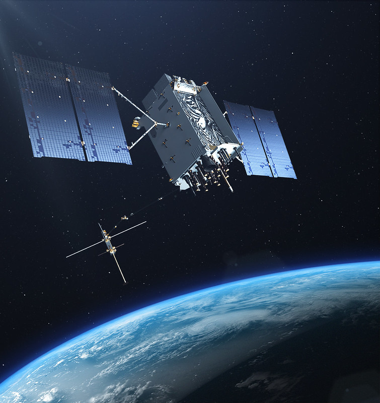
As GPS III evolves, as part of the Air Force’s GPS IIIF acquisition, the satellite’s design will incorporate a new, fully digital navigation payload, an accuracy-enhancing Laser Retro-reflector Array, a Regional Military Protection (RMP) capability, and a government-furnished Search & Rescue payload.Today, Lockheed Martin is under contract with options for up to 32 GPS III and GPS III Follow On (GPS IIIF) satellites. The final GPS III satellite is currently scheduled to be launched in 2023. GPS III satellites will be compatible with international global navigation satellite systems, allowing users to receive signals from any country’s satellites, maximizing their chances of receiving a strong and accurate signal, whether in a natural valley or an urban canyon. Perhaps most important, GPS III satellites will be harder to jam—either by accidental transmissions or by enemies. This gives military users more assured access to GPS.
European Space Agency seeks 5G enhancement to GPS.
The European Space Agency (ESA) has launched a call for proposals to demonstrate new 5G cellular networks’ capabilities to support positioning and timing applications to complement satellite navigation, just as today’s smartphones harness cellular data to support their positioning services.
5G will bring higher speed, larger traffic capacity, and ultra-low-latency (or signal delay) communications. But 5G will also usher in a range of new possibilities for positioning, navigation, and timing (PNT).
The 5G networks will allow new types of measurements made possible by advanced antennas and new positioning signals at higher frequencies, at both base stations and the user receivers. 5G networks will also bring enhanced connectivity to improve cloud-based positioning applications and value-added services. While satellite navigation works optimally in outdoor environments with a wide view of the sky, 5G PNT has the potential to bring PNT to deep ‘urban canyons’ in high-rise city centers and even indoor warehouses, wherever 5G networks are deployed.
The combination of satellite navigation and 5G brings the promise of high performance, secure, and resilient PNT services and a seamless application of PNT applications from outdoor to indoor environments and from rural to urban areas.
With ESA’s new call for ideas, the Agency is inviting proposals to implement pilot projects to demonstrate the viability of 5G PNT solutions in a number of use cases:
- Indoor PNT for ‘Industry 4.0’, as needed to support the operations of smart warehouses and factories or smart city applications requiring transition from indoor to outdoor environments.
- Outdoor applications where a robust back-up to satellite navigation is essential to meet safety requirements, such as autonomous driving or drone navigation
- Applications where robust time and frequency synchronization are necessary, both in outdoor and indoor environments, like smart energy grids or the 5G networks themselves.
As shown, there are multiple efforts underway to improve today’s GNSS and GPS systems’ operation. But there is also general dissatisfaction with the existing systems, and there are efforts underway to develop completely new alternatives. Part two of this FAQ series will look at existing terrestrial-based alternatives to GPS/GNSS/PNT satellites. Part three will look into the future at possible quantum-based and optical-based PNT technologies that could eliminate the need for GPS devices.
References:
Economic Benefits of the Global Positioning System (GPS), National Institute of Standards and Technology
Economic impact to the UK of a disruption to GNSS, London School of Economics
ESA call to demonstrate positioning and timing capabilities of coming 5G networks, European Space Agency
Global Positioning System, Wikipedia
GPS III, Lockheed Martin